
By the end of this chapter, you will be able to:
Mastering these skills will help you conduct topographic surveys with accuracy and confidence, making you a valuable part of any civil engineering project.
Compiled by: Michael Githaiga
Topographic surveying is a fundamental activity in civil engineering projects, providing detailed information about the natural and artificial features of a site. Accurate topographic data ensures proper design, planning, and execution of infrastructure such as roads, bridges, and buildings. In Kenya, where terrain varies widely from urban areas in Nairobi to rural highlands, the choice and calibration of survey tools directly impact project success and cost-effectiveness.
Topographic surveys require specialized instruments that measure angles, distances, and elevations with precision. The selection of appropriate tools depends on the survey scale, terrain complexity, and project requirements. In Kenyan civil engineering practice, commonly used equipment include theodolites, total stations, levels, GPS receivers, and electronic distance measurement (EDM) devices. Understanding the capabilities and limitations of each tool is essential for delivering reliable survey data.
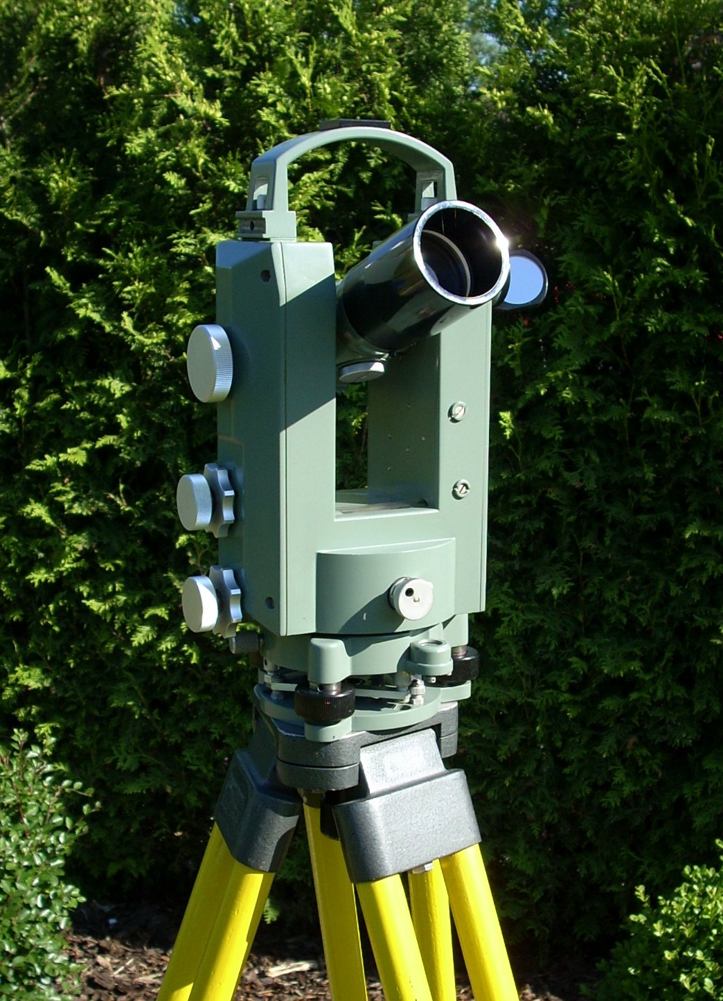
Transit theodolite on tripod outdoors (Source: Wikimedia Commons)
Digital Theodolite: Provides electronic angle readings, reducing human error and speeding data collection.
Optical Theodolite: Traditional model relying on optical readings, still in use for basic tasks.
Total Station: Integrates theodolite functions with EDM and data storage, streamlining topographic surveys.
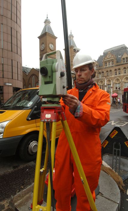
Surveyor using a total station on site (Source: Wikimedia Commons)
Theodolites are vital for establishing horizontal and vertical control networks, which form the backbone of accurate topographic mapping in projects like university campus expansions or highway realignments.
Levelling instruments determine differences in elevation between points, crucial for grading and drainage design.
Dumpy Level: Simple and robust, widely used in construction sites for quick levelling.
Automatic Level: Self-levels using a compensator mechanism, improving accuracy.
A Topcon AT-G6 automatic level used in surveying (Source: Untitled (10))
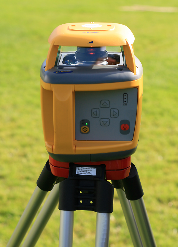
Rotary laser level on tripod (Source: Wikimedia Commons)
Levels are essential when designing foundations or road embankments, for instance, in county government road projects.
EDM devices measure distances using electromagnetic waves, enabling faster and more accurate data collection compared to tape measures.
| Name | Specification | Use |
|---|---|---|
| Total Station | Combines EDM and angle measurement | Measures angles and distances simultaneously |
| EDM Device | Accuracy ±2mm over 1km, Laser or Infrared | Measures distances quickly over varied terrain |
| Reflector Prism | Mounted on a staff, reflects EDM beam | Used with EDM for precise distance measurement |
| Rangefinder | Handheld, short-range distance measurement | Quick approximate distance measurements |
EDM equipment is extensively used in large-scale projects such as airport expansions or dam construction, where measuring long distances accurately is critical.
Global Positioning System (GPS) and Global Navigation Satellite System (GNSS) receivers capture precise geographic coordinates.
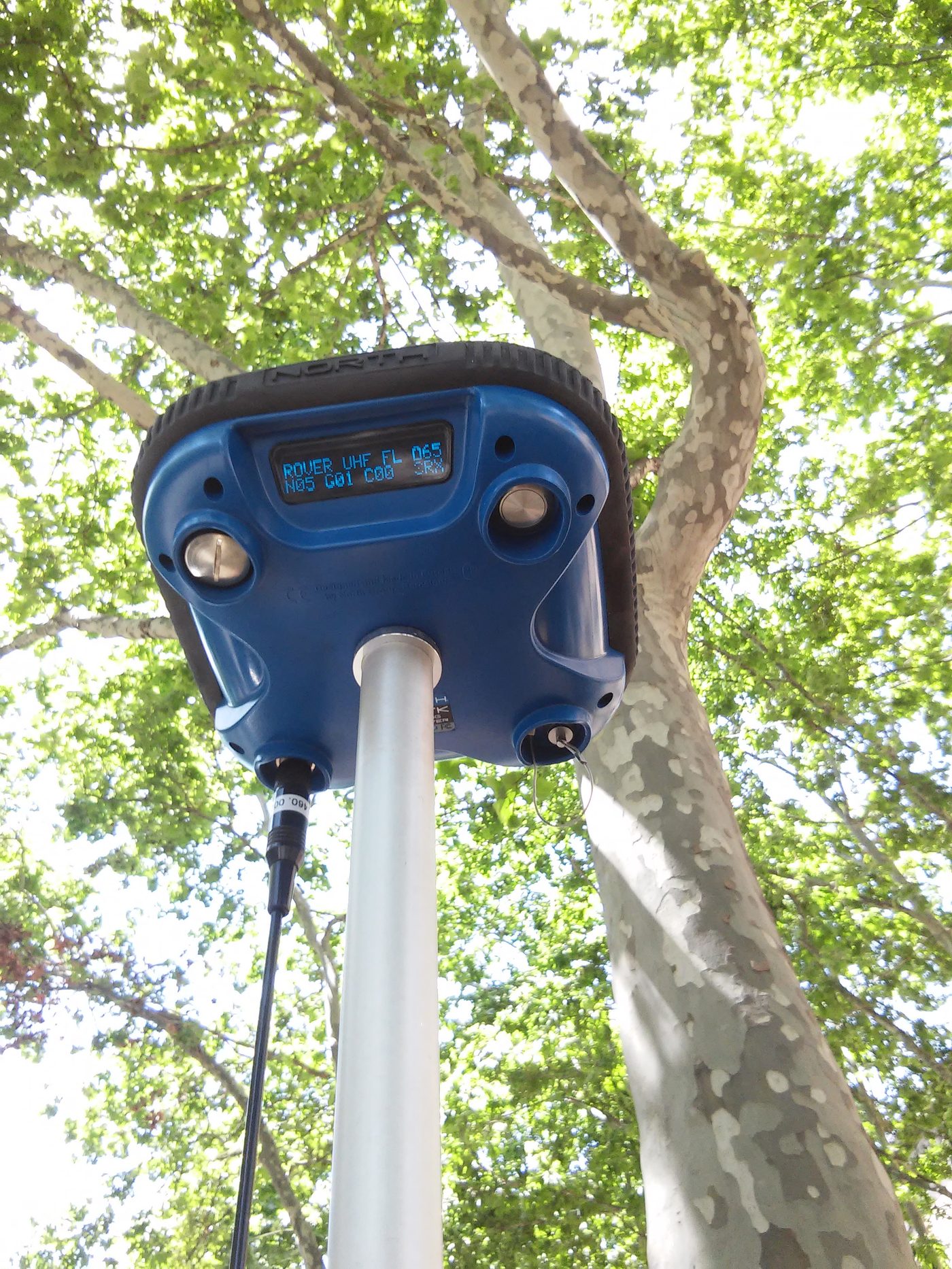
Real-time kinematic GPS receiver on pole (Source: Wikimedia Commons)
Create a free account to open more of this chapter.
Free: practical guides, quick cards, workplace scenarios and more.
Create a free accountThis chapter provides a comprehensive overview of conducting topographic surveys, beginning with the essential tools and equipment used in the process. It emphasizes the importance of proper calibration of these instruments, including detailed procedures for theodolite calibration focusing on collimation, leveling, and the trunnion axis, as well as sensitivity calibration for levels and accuracy checks for EDM equipment. Methods for determining horizontal distances are explored through both direct measurements using tape measures and EDM devices, and indirect techniques such as the stadia and trigonometric methods that rely on angles and vertical distances. Vertical distance measurement is addressed through direct and indirect approaches, highlighting their application in varying field conditions. The chapter also covers effective topographic data collection practices to ensure accurate representation of the surveyed terrain. Finally, it underscores the necessity of regular maintenance of tools and equipment to preserve their precision and extend their operational lifespan.
Type: Individual
| Tools & Equipment | Materials |
|---|---|
| Levelling Instrument | Field Surveying Notebook |
| Tripod Stand | Lime |
| Levelling Staff (Graduated Rod) | Writing Material |
| 20 Meter Long Tape Measure | |
| Marking Pegs | |
| Calculator |
| S/N | Item | Quantity |
|---|---|---|
| 1 | Levelling Instrument | 1 Pc per 2 Candidates |
| 2 | Tripod Stand | 1 Pc per Candidate |
| 3 | Levelling Staff (Graduated Rod) | 1 Pc per Candidate |
| 4 | Field Surveying Notebook | 1 Pc per Candidate |
| 5 | 20 Meter Long Tape Measure | 1 Pc per Candidate |
| 6 | Marking Pegs | 12 Pcs per Candidate |
| 7 | Lime | Sufficient quantity per Candidate |
| 8 | Writing Material (Pens, Pencils, Eraser) | Sufficient per Candidate |
| 9 | Calculator | 1 Pc per Candidate |
| Items to be Evaluated | Marks Available | Marks Obtained | Comments |
|---|---|---|---|
| TASK 1: Preparation and Setup of Topographic Survey Tools | |||
| Wore PPEs (Safety boots, Overall, Gloves) (Award 1 mark for each PPE worn) | 3 | ||
| Inspected all equipment for good working condition (Award 3 marks or zero) | 3 | ||
| Correctly assembled and set up the levelling instrument on the tripod stand (Award 5 marks or zero) | 5 | ||
| Checked and calibrated the levelling instrument for accuracy (Award 4 marks or zero) | 4 | ||
| Selected and prepared marking pegs and lime for marking survey points (Award 3 marks or zero) | 3 | ||
| Prepared the field surveying notebook and writing materials for recording observations (Award 2 marks or zero) | 2 | ||
| Sub-Total | 20 | ||
| PRODUCT CHECKLIST | |||
| All tools and equipment correctly prepared and functional (Award 5 marks or zero) | 5 | ||
| Marking pegs positioned and lime marks clearly visible (Award 5 marks or zero) | 5 | ||
| Field notebook correctly set up with proper headings and ready for data entry (Award 5 marks or zero) | 5 | ||
| Accurate baseline length of 100 meters established using tape measure (Award 5 marks or zero) | 5 | ||
| Sub-Total | 20 | ||
| GRAND TOTAL | 40 | ||
Type: Individual
| Tools & Equipment | Materials |
|---|---|
| Theodolite | Field surveying notebook |
| Tripod stand | Writing pen |
| Adjusting screwdriver | Safety boots |
| Plumb bob | Overall (dustcoat) |
| Spirit level (circular and tubular) | Gloves |
| Measuring tape 30 meters | |
| Calculator | |
| Marking pegs |
| S/N | Item | Quantity |
|---|---|---|
| 1 | Theodolite | 1 Pc per Candidate |
| 2 | Tripod stand | 1 Pc per Candidate |
| 3 | Adjusting screwdriver | 1 Pc per Candidate |
| 4 | Plumb bob | 1 Pc per Candidate |
| 5 | Spirit level (circular and tubular) | 1 Pc per Candidate |
| 6 | Field surveying notebook | 1 Pc per Candidate |
| 7 | Writing pen | 2 Pcs per Candidate |
| 8 | Calculator | 1 Pc per Candidate |
| 9 | Marking pegs | 6 Pcs per Candidate |
| 10 | Measuring tape 30 meters | 1 Pc per Candidate |
| 11 | Safety boots | 1 Pair per Candidate |
| 12 | Overall (dustcoat) | 1 Pc per Candidate |
| 13 | Gloves | 1 Pair per Candidate |
| Items to be Evaluated | Marks Available | Marks Obtained | Comments |
|---|---|---|---|
| TASK 1: Calibration Procedures | |||
| Wore prescribed PPE (safety boots, overall, gloves) (Award 1 mark for each PPE worn correctly) | 3 | ||
| Set up the tripod stand correctly and mounted the theodolite securely (Award 3 marks for correct secure setup or zero) | 3 | ||
| Performed leveling of the theodolite using the circular and tubular spirit levels (Award 5 marks for accurate leveling or zero) | 5 | ||
| Checked and adjusted the line of collimation using a distant marked point at least 50 m away (Award 7 marks for correct collimation procedure and adjustments or zero) | 7 | ||
| Checked and adjusted the trunnion axis for perpendicularity (Award 7 marks for correct procedure and adjustments or zero) | 7 | ||
| Recorded all measurements, observations, and adjustments accurately in the field notebook (Award 5 marks for complete and accurate recording or zero) | 5 | ||
| Maintained a clean and safe working area throughout the procedure (Award 3 marks for good housekeeping and safety or zero) | 3 | ||
| Sub-Total | 33 | ||
| PRODUCT CHECKLIST | |||
| Theodolite is correctly leveled with bubble centered in spirit levels (Award 5 marks if leveling is within manufacturer’s tolerance or zero) | 5 | ||
| Collimation error corrected and confirmed by re-sighting distant target (Award 7 marks if collimation error is eliminated or within acceptable limits) | 7 | ||
| Trunnion axis adjustment verified and perpendicularity confirmed (Award 7 marks if trunnion axis is perpendicular within tolerance) | 7 | ||
| All observations and adjustments are accurately and neatly documented (Award 3 marks for complete and legible documentation) | 3 | ||
| Sub-Total | 22 | ||
| GRAND TOTAL | 55 | ||
At the start of this chapter we promised you would be able to:
Tick each one you can genuinely do.
So, are you there yet?
You're competent when you can confidently do 50% or more of what this chapter promised.
Sign in to record how you're doing.